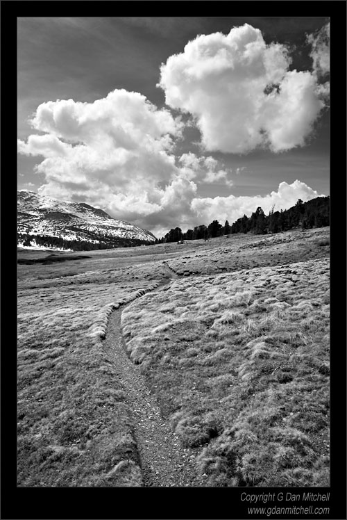
Friday, May 25, 2007

On Hiking Poles

No, not hiking Poles... hiking poles... Though I suspect that they use them in Poland, too.

I see that Tom has posted a link to aWildebeat report on hiking poles today.

A short excerpt:

Well what we saw in that study was as -- at the lesser slope, the fifteen degree slope... some people used the poles very effectively, a lot of people didn't seem to make use of the poles at all... As the slope got steeper, then we saw a distinct difference in terms of both men and women tended to use the poles... Then at the steepest slope, when we got them at twenty five degrees, then everybody used the poles much better ...
See Tom's post for links back to the full story.

A few comments of my own on hiking poles.

For a long time I thought that hiking poles (a.k.a. "trekking poles") were for effete wimps. I couldn't imagine myself ever using such things. (Though I wasn't above picking up the occasional trailside stick and using it to get past rough patches, over a snowfield, or across a creek.)

Then some friends of mine started showing up for pack trips with old ski poles. Though I was still skeptical, these were my friends and hiking buddies, so it was a bit harder to dismiss them. This was especially true when one of them would toss me a pole to use on a creek crossing. ;-)

I finally decided I had to give them a try and perhaps 5-6 years ago I picked up a pair. I purchased a decent set of lightweight REI poles that collapsed down to what I regarded as a reasonable size to attach to the pack... and that is pretty much where they stayed. I ended up carrying them 20 miles for every mile that I used them.

But time marches on, and I got older. Recently I have made it my policy to use the poles pretty much all the time when I'm carrying a backpacking load. Advantages? They do help with balance on rough terrain - and they help a lot if you find yourself hiking after dark. They provide some relief on uphill trails also, especially for those of us who learned to diagonal stride for cross-country skiing and can add a bit of push with our arms. I use them on the downhill sections but, contrary to what my friends tell me, I don't think they really take much of a load off my knees - though they may slow me down a bit and soften the blow for that reason.

Another advantage is that with the right kind of tarp or tent (or tarptent...) the poles can substitute for normal tent poles.

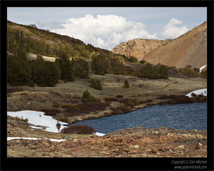
Related to the story that Tom links to, a few years ago I discovered - much to my surprise - how useful poles can be on really rough terrain. I had assumed that poles would be fine for trail hiking but that off trail they would be a burden not worth the bother. On a hike up
Giddy Giddy Gulch on Mt. Shasta I discovered how wrong I was. Using the poles I was no longer a somewhat unsteady biped, grabbing for nearby boulders if I got a bit off balance. Instead I was a confident quadruped, able to keep three points of contact while moving one foot. Except in very rough situations (verging on bouldering) the poles turned out help a lot.

So, now I use them in all of these circumstances... and encourage others to do the same.

21 Favorite Photographs and the Stories Behind Them

I see that a story at my photography site is included in a post at Jim Goldstein's blog today:

21 Favorite Photos And The Stories Behind Them - Since initiating the project on May 14th I?ve been introduced, and in some cases re-introduced, to some great photographers. The subject material, photographic styles and skill levels of those submitting may vary, but the one constant shared by all is a passion to capture and share the world as they see it. [JMG-Galleries]

Follow the title link within the excerpt from Jim's post to see the full list. (Thanks for including my story, Jim.)

Tuesday, May 22, 2007

Monday, May 21, 2007

Crossing Mono Pass

Crossing Mono Pass, Sierra Crest

Crossing Mono Pass, Sierra Crest. Yosemite National Park, California. May 20, 2007. © Copyright G Dan Mitchell

Tioga Pass Blitz

The anatomy of a one-day blitz trip to the Tuolumne/Tioga area...

Yesterday morning: Up at 3:50 a.m. Eat four strawberries and a cup of coffee and hit the road for Yosemite. Stop at the Starbucks at Highways 120 and 99 for a quick breakfast and continue on to the park. Arrive at the entrance around 7:30 or 7:45 - kiosk not open yet so I figure I'll buy my new annual pass on the way out.

10 minutes later I spot beautiful dogwoods in bloom at the bottom of a hill and stop for 20-30 minutes of photography. Back in the car I turn onto 120 and head on toward Tuolumne, trying not to stop for any of a dozen or more photo ops. There wasn't much snow considering that it is still only late May - some remnants at around 8:00 feet, but many bare areas even at higher elevations.

Coming around the last turn into Tuolumne Meadows the familiar view appears before me. The meadow is still quite brown, though it is starting to become green in the wetter areas. In contrast to past years, there is only a small flooded area near the start of the meadow. Nothing is open there yet so I head on up to Tioga Pass.

At the pass I discover that the tarn next to the parking lot before the pass is now "off limits" due to "restoration of amphibian population" or something. Surprisingly the tarn is still mostly frozen as are other nearby tarns. After my obligatory visit to the actual pass I head back down to the Mono Pass trail and load up my pack with lots of photo gear, some extra clothes (it is cold and windy) and hit the trail.

While there is not a lot of snow, there are a lot of wet spots and the creeks are higher than usual. (Though not as high as they were at the start of the season last year.) I wade a few creeks near the start of the hike. I can report that Goretex boots and serious gaiters (Thanks, Tom, for reminding us how to spell 'gaiters') will keep your feet almost sort of dry even if you walk right through the creek. I climb over the two moraines that follow the creek crossings and then settle into the more gradual terrain leading to the Spillway Lake trail.

I briefly consider going to Spillway and Parker Pass, but instead stick to the main trail to Mono Pass. (Too much snow in spots and not many people around - hiking alone, it seems that discretion is wise. Which turns out to be true later...) The trail climbs more steeply after this junction and there is more snow to cross or bypass. Getting closer to the pass, I pause at one of the old cabins before finishing up the trail. At the pass it is quite windy and colder than what will be typical later in the season. I spend a good chunk of time at the pass, photographing a hiker heading over into Bloody Canyon.

I begin the return trip, enjoying the easier hiking in the downhill direction. As I descend I realize that I'm dealing with a bit of altitude sickness, along with serious fatigue from starting my day so early so I slow down and take it easy. There is no hurry since all I have to do is get back to the car in time to drive down the road a ways and shoot the sunset.

On the steep section I get ahead of myself' and trip on rocks. Ouch! I manage to bang up my knees, my shoulder, and one hand a bit. (Probably wouldn't have hurt myself, and might not have fallen at all, except that I was trying so hard to make sure that I didn't fall on my camera or my tripod...) A strange thing... after seeing almost no one on the trail all day, right after I fall I look back and there is another hiker about 15 feet behind me. After spending a minute making sure that everything is still working, I head on down the trail - a bit slower and more cautiously than before.

The light had been less than exceptional on the hike out, but on the way back the late afternoon light takes on a bit of a golden color and some nice clouds appear - so I pause frequently to take pictures. By the time I get back to the creek crossings I'm really feeling the effects of altitude, suffering from a pretty good headache.

I head on down to Tuolumne and take a half hour nap before driving on towards Olmsted Point to take a few photographs as the light fades. Now it is time to start the long drive home - but I'm more tired than I can recall being on a one-day trip and I still have the headache. As I pass through the park I stop every 15 minutes or so and take a short nap - I'm not interested in falling asleep while driving! Finally I get to the entrance station and the lower altitude begins to relieve the headache and I leave the park. (The entrance station is closed again - even though I brought money for an annual pass, there is no one to sell me one!)

So I drive on, out of the park and finally back into the valley and then to Oakdale. I stop at my 120/99 Starbucks a few minutes after 11:00 to fortify myself with a double espresso and a cooking for the remainder of the drive. I finally arrive home at 1:10 and simply go inside and crawl into bed, leaving the unpacking for the next morning.

Photos to follow...

Dan

Tioga Pass Blitz

The anatomy of a one-day blitz trip to the Tuolumne/Tioga area...

Yesterday morning: Up at 3:50 a.m. Eat four strawberries and a cup of coffee and hit the road for Yosemite. Stop at the Starbucks at Highways 120 and 99 for a quick breakfast and continue on to the park. Arrive at the entrance around 7:30 or 7:45 - kiosk not open yet so I figure I'll buy my new annual pass on the way out.

10 minutes later I spot beautiful dogwoods in bloom at the bottom of a hill and stop for 20-30 minutes of photography. Back in the car I turn onto 120 and head on toward Tuolumne, trying not to stop for any of a dozen or more photo ops. There wasn't much snow considering that it is still only late May - some remnants at around 8:00 feet, but many bare areas even at higher elevations.

Coming around the last turn into Tuolumne Meadows the familiar view appears before me. The meadow is still quite brown, though it is starting to become green in the wetter areas. In contrast to past years, there is only a small flooded area near the start of the meadow. Nothing is open there yet so I head on up to Tioga Pass.

At the pass I discover that the tarn next to the parking lot before the pass is now "off limits" due to "restoration of amphibian population" or something. Surprisingly the tarn is still mostly frozen as are other nearby tarns. After my obligatory visit to the actual pass I head back down to the Mono Pass trail and load up my pack with lots of photo gear, some extra clothes (it is cold and windy) and hit the trail.

While there is not a lot of snow, there are a lot of wet spots and the creeks are higher than usual. (Though not as high as they were at the start of the season last year.) I wade a few creeks near the start of the hike. I can report that Goretex boots and serious gaiters (Thanks, Tom, for reminding us how to spell 'gaiters') will keep your feet almost sort of dry even if you walk right through the creek. I climb over the two moraines that follow the creek crossings and then settle into the more gradual terrain leading to the Spillway Lake trail.

I briefly consider going to Spillway and Parker Pass, but instead stick to the main trail to Mono Pass. (Too much snow in spots and not many people around - hiking alone, it seems that discretion is wise. Which turns out to be true later...) The trail climbs more steeply after this junction and there is more snow to cross or bypass. Getting closer to the pass, I pause at one of the old cabins before finishing up the trail. At the pass it is quite windy and colder than what will be typical later in the season. I spend a good chunk of time at the pass, photographing a hiker heading over into Bloody Canyon.

I begin the return trip, enjoying the easier hiking in the downhill direction. As I descend I realize that I'm dealing with a bit of altitude sickness, along with serious fatigue from starting my day so early so I slow down and take it easy. There is no hurry since all I have to do is get back to the car in time to drive down the road a ways and shoot the sunset.

On the steep section I 'get ahead of myself' and trip on rocks. Ouch! I manage to bang up my knees, my shoulder, and one hand a bit. (Probably wouldn't have hurt myself, and might not have fallen at all, except that I was trying so hard to make sure that I didn't fall on my camera or my tripod...) A strange thing... after seeing almost no one on the trail all day, right after I fall I look back and there is another hiker about 15 feet behind me. After spending a minute making sure that everything is still working, I head on down the trail - a bit slower and more cautiously than before.

The light had been less than exceptional on the hike out, but on the way back the late afternoon light takes on a bit of a golden color and some nice clouds appear - so I pause frequently to take pictures. By the time I get back to the creek crossings I'm really feeling the effects of altitude, suffering from a pretty good headache.

I head on down to Tuolumne and take a half hour nap before driving on towards Olmsted Point to take a few photographs as the light fades. Now it is time to start the long drive home - but I'm more tired than I can recall being on a one-day trip and I still have the headache. As I pass through the park I stop every 15 minutes or so and take a short nap - I'm not interested in falling asleep while driving! Finally I get to the entrance station and the lower altitude begins to relieve the headache and I leave the park. (The entrance station is closed again - even though I brought money for an annual pass, there is no one to sell me one!)

So I drive on, out of the park and finally back into the valley and then to Oakdale. I stop at my 120/99 Starbucks a few minutes after 11:00 to fortify myself with a double espresso and a cooking for the remainder of the drive. I finally arrive home at 1:10 and simply go inside and crawl into bed, leaving the unpacking for the next morning.

Photos to follow...

Dan

Half Dome and Glacial Erratics, Olmsted Point

Half Dome and Glacial Erratics, Olmsted Point

Half Dome and Glacial Erratics, Olmsted Point. Yosemite National Park, California. May 20, 2007. © Copyright G Dan Mitchell

Saturday, May 19, 2007

Friday, May 18, 2007

Dweeb Report Returns!

For many Sierra Nevada fans, the Mammoth Dweeb Report is the place to go for accurate information about eastern Sierra weather... along with a healthy dose of speculation about where the weather might be headed.

A couple weeks ago my link to the site stopped working. But tonight I found the Dweeb Report at a different URL: http://izotz.com/dweebreport/.

Thursday, May 17, 2007

Warmest January-April ever; new record Arctic sea ice minimum

From Dr. Jeff Masters' WunderBlog:

Warmest January-April ever; new record Arctic sea ice minimum. April 2007 was the third warmest April for the globe on record, and the first four months of 2007 were the warmest ever, according to statistics released this week by the National Climatic Data Center. The global average temperature for April was 1.19°F/0.66°C above the 20th century mean. Over land, April global temperatures were the warmest ever measured. Ocean temperatures were a bit cooler (seventh warmest on record), thanks to the cooling associated with the di...
Read More [Dr. Jeff Masters' WunderBlog]

Tuesday, May 15, 2007

Yosemite Valley Web Cam Strikes Again

Seen this morning in the RSS feed from Yosemite Blog:

Good Morning.

Grabbed this image from the Yosemite Association webcam just a few seconds ago. What a beautiful sunrise.


[Yosemite Blog]

Sunday, May 13, 2007

Big Basin and Mt. Abee

Yesterday I hiked in a park that I visited often when I was younger, but where I have hiked infrequently in recent years. When I was a kid my family would often go to Big Basin State Park between (what was not yet known as) Silicon Valley and Santa Cruz, often to picnic and play in the creek. On occasion we would also do some hiking.

I'm almost embarrassed to say that I started my morning by spending the better part of an hour hiking half of the little Redwood Trail loop by the parking lot. My excuse is that I was carrying my photo gear, and I ended up spending a bunch of time photographing some old redwoods.

Having finished with this I started hiking with a vague plan to hike out on part of the Skyline to the Sea Trail. However, some of the trail junctions are a bit confusing and I wasn't carrying a map, and I ended up sort of inventing the hike as I did it. (Regarding the confusing trail signs... I ran into one group of backpackers four times during my hike. They had gotten confused and backtracked several times.) Eventually I ended up on a steep road that joined a fire road heading to Mt. Abee.

The route was steadily uphill with the exception of a few more or less level spots near the top. "Mt. Abee" turns out to be an open spot along the trail where there is a bench from which one can see all the way down Waddell Creek to the ocean. Looking closely you can spot cars on the coast highway and even kites flying on the beach.

All in all, not the world's most spectacular hike but pleasant enough and a good way to spend a few morning hours at Big Basin.

Friday, May 11, 2007

New Home of dan's outside?

I've been having difficulties with the server than handles the original dan's outside site, and I'm thinking of transferring the blog here. I'm probably going to begin parallel posting at both sites this weekend.